 Catálogo REDIAM
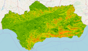
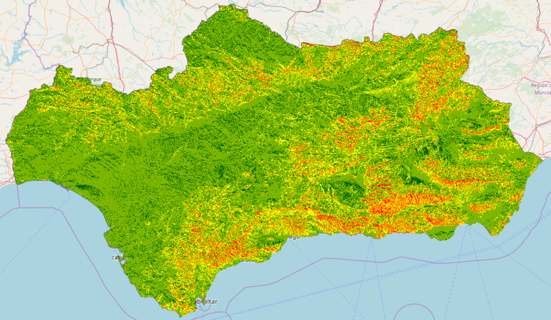
REDIAM. WMS Riesgo Orográfico de Incendios. 2016
Servicio WMS correspondiente al estudio de riesgo orográfico realizado por el Centro Operativo Regional y representado por disitntos mapas que simbolizan los distintos riesgos de incendios asociados a la orografía y representados en tres escalas distintas: Paisaje, Cuenca y Local. Nodo de la Red de Información Ambiental de Andalucía. Junta de Andalucía. Integrado en la Infraestructura de Datos Espaciales de Andalucía, siguiendo las directrices del Sistema Cartográfico de Andalucía.
Simple
- Date (Revision)
- 2018-01-12T11:41:16
- Status
- Completed
- Point of contact
-
Organisation name Individual name Electronic mail address Role Consejería de Medio Ambiente y Ordenación del Territorio. Junta de Andalucía
--
Point of contact
-
ISO
-
-
infoMapAccessService
-
- Keywords
-
-
WMS
-
Andalucía
-
REDIAM
-
Incendio
-
Riesgo
-
Orografía
-
IDEAndalucia
-
- Use limitation
-
Para saber la licencia hay que mirar el campo de acceso y uso.
- Access constraints
- Other restrictions
- Use constraints
- Other restrictions
- Other constraints
-
Este servicio se puede usar de modo libre y gratuito siempre que se mencione a los autores y propietarios de la información
- Service Type
- OGC:WMS
- Service Version
-
1.3.0
- Fees
-
Gratuito
))
- Coupling Type
- Tight
- Contains Operations
- Distribution format
-
Name Version WMS
1.3.0
- OnLine resource
-
Protocol Linkage Name OGC:WMS-1.3.0-http-get-map
http://www.juntadeandalucia.es/medioambiente/mapwms/REDIAM_riesgo_orografico_incendios_16?
- Units of distribution
-
Ficha WMS Canal REDIAM
- OnLine resource
-
Protocol Linkage Name WWW:LINK-1.0-http--related
http://www.juntadeandalucia.es/medioambiente/site/rediam/menuitem.04dc44281e5d53cf8ca78ca731525ea0/?vgnextoid=62d8a08e338d0610VgnVCM1000001325e50aRCRD&vgnextchannel=8ca090a63670f210VgnVCM2000000624e50aRCRD&vgnextfmt=rediam&lr=lang_es Ficha WMS Canal REDIAM
- Hierarchy level
- Service
Attributes
Conformance result
- Date (Publication)
- 2010-12-08
Citation identifier
- Explanation
-
Consultar el reglamento mencionado
- Pass
- Yes
- File identifier
- 04c213902a27f5dbcb531c0eb5776258b3886128 XML
- Metadata language
- Spanish; Castilian
- Character set
- UTF8
- Hierarchy level
- Service
- Date stamp
- 2022-09-01T10:42:37
- Metadata standard name
-
ISO 19119/2005
- Metadata standard version
-
1.0
- Metadata author
-
Organisation name Individual name Electronic mail address Role Consejería de Sostenibilidad, Medio Ambiente y Economía Azul. Junta de Andalucía
--
Point of contact
Overviews
Spatial extent
Provided by
