 Catálogo REDIAM
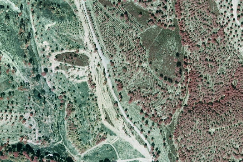
Vuelo fotogramétrico Incendio de Calañas (Huelva), 2004
Colección de fotogramas escaneados del vuelo realizado en 2004 a escala 1:15.000 sobre el ámbito afectado por el Incendio de Calañas (Huelva).(V096_vf)
Simple
- Date (Creation)
- 2004-09-18
- Date (Revision)
- 2008-02-29
- Presentation form
- Digital image
- Purpose
-
Permitir mediante procesos técnicos la obtención de una serie de productos cartográficos, tales como: fotogramas digitales georreferenciados, apoyo de campo y aerotriangulación, modelo digital de elevaciones, ortofotos digitales y mosaicos; o el levantamiento de información a través de la interpretación directa.
- Status
- Historical archive
- Point of contact
-
Organisation name Individual name Electronic mail address Role Consejería de Medio Ambiente. Junta de Andalucía
Author
-
Observación del Territorio
-
-
Observación del Territorio. Producto primario
-
- Theme
-
-
Fotografía aérea
-
Fotogrametría
-
Vuelo de bajo nivel
-
-
GEMET - INSPIRE themes, version 1.0
-
-
Ortoimágenes
-
-
Registro de temas REDIAM
-
-
Incendios forestales
-
Teledetección y caracterización del territorio
-
- Use limitation
-
Para saber la licencia hay que mirar el campo de acceso y uso.
- Access constraints
- Other restrictions
- Use constraints
- Other restrictions
- Other constraints
-
Creative Commons Attribution 4.0 International Public License
- Spatial representation type
- Grid
- Language
- Spanish; Castilian
- Character set
- UTF8
- Topic category
-
- Imagery base maps earth cover
))
- Supplemental Information
-
01030102
- Reference system identifier
- EPSG:23030
- Reference system identifier
- INSPIRE RS registry / http://www.opengis.net/def/crs/EPSG/0/23030
- Distribution format
-
Name Version MrSID
- Hierarchy level
- Dataset
Conformance result
- Date (Publication)
- 2010-12-08
Citation identifier
- Explanation
-
Consultar el reglamento mencionado
- Pass
- Yes
- Statement
-
El vuelo fotogramétrico incluye las siguientes fases: 1-Vuelo y cobertura fotográfica. 2-Toma de datos GPS en vuelo. 3-Procesado de los datos GPS e IMU. 4-Procesado de las imágenes digitales.
- Description
-
Vuelo Fotogramétrico Analógico
- File identifier
- 1062c312-f869-4529-bb32-289754446443 XML
- Metadata language
- Spanish; Castilian
- Character set
- UTF8
- Hierarchy level
- Dataset
- Date stamp
- 2022-09-01T09:36:37
- Metadata standard name
-
ISO 19115 "NEM"
- Metadata standard version
-
2003 "1.0"
- Metadata author
-
Organisation name Individual name Electronic mail address Role Consejería de Sostenibilidad, Medio Ambiente y Economía Azul. Junta de Andalucía
Author
Overviews
Spatial extent
Provided by
