 Catálogo REDIAM
Red de Puntos de Apoyo de Andalucía (RPA)
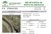
Reseñas en pdf divididas por hojas 50.000 de los puntos de apoyo referentes a las distintas campañas realizadas para los distintos vuelos de Andalucía. (003V_dp)
Simple
- Date (Creation)
- 2009-08-17
- Citation identifier
- Sin identificador
- Presentation form
- Digital document
- Purpose
-
Disponibilidad de Puntos de Apoyo para los proyectos fotogramétricos.
- Status
- Completed
- Point of contact
-
Organisation name Individual name Electronic mail address Role Consejería de Medio Ambiente. Junta de Andalucía
Author
- Theme
-
-
Fotografía aérea
-
Fotogrametría
-
Vuelo de bajo nivel
-
-
GEMET - INSPIRE themes, version 1.0
-
-
Sistemas de coordenadas de referencia
-
- Use limitation
-
Para saber la licencia hay que mirar el campo de acceso y uso.
- Access constraints
- Other restrictions
- Use constraints
- Other restrictions
- Other constraints
-
Creative Commons Attribution 4.0 International Public License
- Spatial representation type
- Text, table
- Language
- Spanish; Castilian
- Character set
- UTF8
- Topic category
-
- Imagery base maps earth cover
- Location
))
- Supplemental Information
-
0201
- Reference system identifier
- EPSG:23030
- Reference system identifier
- INSPIRE RS registry / http://www.opengis.net/def/crs/EPSG/0/4258
- Distribution format
-
Name Version mdb
jpeg
pdf
- Units of distribution
-
Kml
- OnLine resource
-
Protocol Linkage Name WWW:LINK-1.0-http--related
http://www.juntadeandalucia.es/medioambiente/portal_web/rediam/documentos/rpa.kmz Kmz Red de Puntos de Apoyo Topográfico de Andalucía
- Units of distribution
-
Datos en descarga
- OnLine resource
-
Protocol Linkage Name WWW:LINK-1.0-http--related
http://descargasrediam.cica.es/repo/s/RUR?path=%2F02_LOCALIZACION_GEOGRAFICA%2F01_SISTEMAS_REFERENCIA%2FRPA_Resenas_003V_dp Descarga Red de Puntos de Apoyo Topográfico de Andalucía (RPA) (RPA_Resenas_003V_dp)
- Units of distribution
-
Publicación web
- OnLine resource
-
Protocol Linkage Name WWW:LINK-1.0-http--related
http://www.juntadeandalucia.es/medioambiente/site/rediam/menuitem.04dc44281e5d53cf8ca78ca731525ea0/?vgnextoid=de4d84e45014a310VgnVCM2000000624e50aRCRD&vgnextchannel=48f87d087270f210VgnVCM1000001325e50aRCRD&vgnextfmt=rediam&lr=lang_es Red de Puntos de Apoyo Topográfico de Andalucía
- Hierarchy level
- Series
Conformance result
- Date (Publication)
- 2010-12-08
Citation identifier
- Explanation
-
Consultar el reglamento mencionado
- Pass
- Yes
- Statement
-
Toda información referente a los datos y los procesos correspondientes a las distintas fases que conllevó el proceso.
- Description
-
Vértices Geodésicos de la Red Geodésica Nacional, Red REGENTE y Red Iberia95
- File identifier
- 222c257e-64a7-45ee-9373-0e66588bd430 XML
- Metadata language
- Spanish; Castilian
- Character set
- UTF8
- Hierarchy level
- Dataset
- Date stamp
- 2022-09-01T11:24:53
- Metadata standard name
-
ISO 19115 "NEM"
- Metadata standard version
-
2003 "1.0"
- Metadata author
-
Organisation name Individual name Electronic mail address Role Consejería de Sostenibilidad, Medio Ambiente y Economía Azul. Junta de Andalucía
Author
Overviews

Spatial extent
Provided by
