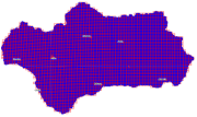
Cuadrículas y cortes cartográficos de Andalucía
Información vectorial en formato shape correspondiente a las Cuadrículas y Cortes Cartográficos utilizados en los proyectos Ortofotografía de Andalucía y PNOA, según prescripciones del Instituto Geográfico Nacional, así como para la obtención de otros productos (ráster en general) de proyectos LiDAR y fotogramétricos a nivel regional y local: corte de hojas 1:10.000 y 1:5.000 y cortes de 1x1 km, 2x2 km, 5x5 km, 10x10 km, 20x20 km y 80x80 km. (020V_dp).
Se incluye información (opciones de distribución) de las Cuadrículas Geográficas del IGN (MTN25, MTN50, BTA5, BTA10), las Mallas Terrestres definidas por el Ministerio para la Transición Ecológica (1x1 km, 10x10 km) y las Cuadrículas de Referencia de la Agencia Europea de Medio Ambiente (1 km, 10 km, 50 km, 100 km).
Simple
- Date (Creation)
- 2009-07-15
- Date (Revision)
- 2020-05-26
- Citation identifier
- Sin identificador
- Presentation form
- Digital map
- Purpose
-
Información Geográfica de Referencia.
Disponibilidad de cuadrículas y cortes cartográficos normalizados de referencia para la generación de Bases Cartográficas (obtención de productos ráster procedentes de diversos proyectos de Fotogrametría (ortofotos, MDE,...) y LiDAR, así como otras variables ambientales y del territorio).
- Status
- Completed
- Point of contact
-
Organisation name Individual name Electronic mail address Role Consejería de Medio Ambiente y Ordenación del Territorio. Junta de Andalucía
Author
- Theme
-
-
Proyección cartográfica
-
IDEAndalucia
-
Opendata
-
Zonificación
-
Mapas
-
Cartografía
-
-
GEMET - INSPIRE themes, version 1.0
-
-
Sistema de cuadrículas geográficas
-
- Access constraints
- Other restrictions
- Use constraints
- Other restrictions
- Other constraints
-
Creative Commons Attribution 4.0 International Public License (CC BY 4.0)
- Spatial representation type
- Vector
- Denominator
- 10000
- Language
- Spanish; Castilian
- Character set
- UTF8
- Topic category
-
- Imagery base maps earth cover
))
- Supplemental Information
-
0202
- Reference system identifier
- EPSG:25830
- Distribution format
-
Name Version ESRI Shapefile
1.0
- Units of distribution
-
Servicio WMS
- OnLine resource
-
Protocol Linkage Name OGC:WMS-1.3.0-http-get-map
http://www.juntadeandalucia.es/medioambiente/mapwms/REDIAM_cuadriculas_geograficas_ETRS89? WMS Cuadrículas geográficas de Andalucía
- Units of distribution
-
Kml
- OnLine resource
-
Protocol Linkage Name OGC:KML
http://www.juntadeandalucia.es/medioambiente/portal_web/rediam/productos/ServiciosOGC/KML/Cartografia_ambiental/Localizacion_geografica/cuadriculas_geograficas.kml Fichero cuadriculas_geograficas.kml
- Units of distribution
-
Ficha WMS
- OnLine resource
-
Protocol Linkage Name WWW:LINK-1.0-http--related
http://www.juntadeandalucia.es/medioambiente/site/rediam/menuitem.04dc44281e5d53cf8ca78ca731525ea0/?vgnextoid=bf6b8ce09ccee210VgnVCM1000001325e50aRCRD&vgnextchannel=33be7c119370f210VgnVCM2000000624e50aRCRD&vgnextfmt=rediam&lr=lang_es Ficha WMS Cuadrículas geográficas de Andalucía
- Units of distribution
-
Datos en descarga
- OnLine resource
-
Protocol Linkage Name WWW:LINK-1.0-http--related
http://descargasrediam.cica.es/repo/s/RUR?path=%2F02_LOCALIZACION_GEOGRAFICA%2F02_CUADRICULAS_GEOGRAFICAS%2FAND_Cuadriculas_y_Cortes Descarga Cortes cartográficos de Andalucía (AND_Cuadriculas_y_Cortes)
- Units of distribution
-
Servicio WFS
- OnLine resource
-
Protocol Linkage Name OGC:WFS
http://www.juntadeandalucia.es/medioambiente/mapwms/REDIAM_WFS_WMS_cortes_topograficos_5x5km_ETRS89? WFS Cuadrícula 5x5 km ampliada ETRS89 UTM huso 30
- Units of distribution
-
Datos en descarga
- OnLine resource
-
Protocol Linkage Name WWW:LINK-1.0-http--related
https://www.eea.europa.eu/data-and-maps/data/eea-reference-grids-2 EEA Reference Grid
- Units of distribution
-
Datos en descarga
- OnLine resource
-
Protocol Linkage Name WWW:LINK-1.0-http--related
https://www.miteco.gob.es/es/biodiversidad/servicios/banco-datos-naturaleza/informacion-disponible/bdn-cart-aux-malla-terrestre.aspx Malla terrestre MITECO
- Units of distribution
-
Datos en descarga
- OnLine resource
-
Protocol Linkage Name WWW:LINK-1.0-http--related
https://www.ign.es/web/ign/portal/cbg-area-cartografia Cuadrículas geográficas IGN
- Units of distribution
-
Servicio WMS
- OnLine resource
-
Protocol Linkage Name OGC:WMS-1.3.0-http-get-map
http://www.ign.es/wms-inspire/cuadriculas? Cuadrículas cartográficas del IGN
- Hierarchy level
- Dataset
Conformance result
- Date (Publication)
- 2010-12-08
Citation identifier
- Explanation
-
Consultar el reglamento mencionado
- Pass
- Yes
- Statement
-
Los cortes en ETRS89_30 son originales, no proyectados a partir de otro sistema de referencia.
El corte regional 1:10.000 se ha obtenido a partir de la extracción de las coordenadas topográficas de la cuadrícula 1:10.000 con ampliación de 100 m y redondeo de 10 m.
La capa de información vectorial en formato shape está revisada y no tienen errores topológicos.
- File identifier
- 4f2631b4-5c8a-428a-beea-3a84f92bc871 XML
- Metadata language
- Spanish; Castilian
- Character set
- UTF8
- Hierarchy level
- Dataset
- Date stamp
- 2022-09-05T06:19:11
- Metadata standard name
-
ISO 19115 "NEM"
- Metadata standard version
-
2003 "1.0"
- Metadata author
-
Organisation name Individual name Electronic mail address Role Consejería de Sostenibilidad, Medio Ambiente y Economía Azul. Junta de Andalucía
Author
Overviews

Spatial extent
))
Provided by

 Catálogo REDIAM