 Catálogo REDIAM
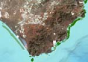
REDIAM. WMS/WFS Cartografía de praderas de fanerógamas marinas en un sector del Parque Natural de Cabo de Gata-Níjar a partir de sensores hiperespectrales
Servicio WMS/WFS correspondiente a la cartografía de delimitación de las praderas de fanerógamas marinas (Posidonia oceánica y Cymodocea nodosa) obtenida mediante tratamiento específico de imágenes hiperespectrales (CASI, Chris Proba) en un sector del Parque Natural de Cabo de Gata. Agencia de Medio Ambiente y Agua. Nodo de la Red de Información Ambiental de Andalucía. Junta de Andalucía. Integrado en la Infraestructura de Datos Espaciales de Andalucía, siguiendo las directrices del Sistema Cartográfico de Andalucía.
Simple
- Date (Revision)
- 2013-01-15T14:59:31
- Status
- Completed
- Point of contact
-
Organisation name Individual name Electronic mail address Role Consejería de Medio Ambiente y Ordenación del Territorio. Junta de Andalucía
--
Point of contact
- Theme
-
-
WMS
-
REDIAM
-
Andalucía
-
cambio climático
-
aumento del nivel del mar
-
costa
-
humanInteractionService
-
IDEAndalucia
-
-
Registro de temas REDIAM
-
-
Teledetección y caracterización del territorio
-
-
GEMET - INSPIRE themes, version 1.0
-
-
Rasgos geográficos oceanográficos
-
- Use limitation
-
Este servicio se puede usar de modo libre y gratuito siempre que se mencione a los autores y propietarios de la información
- Access constraints
- Other restrictions
- Use constraints
- Other restrictions
- Other constraints
-
Creative Commons Reconocimiento 4.0 (CC BY 4.0)
- Service Type
- OGC:WMS
- Service Version
-
1.3.0
- Fees
-
Gratuito
))
- Coupling Type
- Tight
- Contains Operations
- Distribution format
-
Name Version WMS
1.3.0
WFS
1.1.0
- Units of distribution
-
Servicio WMS
- OnLine resource
-
Protocol Linkage Name OGC:WMS-1.3.0-http-get-map
https://www.juntadeandalucia.es/medioambiente/mapwms/REDIAM_fanerogamas_pn_cabo_gata? REDIAM. WMS Praderas de fanerógamas marinas en un sector del PN de Cabo de Gata-Níjar obtenida mediante sensores hiperespectrales
- Units of distribution
-
Ficha Canal REDIAM
- OnLine resource
-
Protocol Linkage Name WWW:LINK-1.0-http--link
https://www.juntadeandalucia.es/medioambiente/portal/landing-page-servicio-ogc/-/asset_publisher/1qlWV3LW9vV6/content/rediam.-wms-proyecto-camp.-mejora-de-los-criterios-de-gesti-c3-b3n-del-dominio-p-c3-bablico-mar-c3-adtimo-terrestre-e-hidr-c3-a1ulico-del-levante-de-a/20151 Servicio WMS-WFS Praderas de fanerógamas marinas en un sector del PN de Cabo de Gata-Níjar obtenida mediante sensores hiperespectrales
- Units of distribution
-
Servicio WFS
- OnLine resource
-
Protocol Linkage Name OGC:WFS
https://www.juntadeandalucia.es/medioambiente/mapwms/REDIAM_fanerogamas_pn_cabo_gata? REDIAM. WFS Praderas de fanerógamas marinas en un sector del PN de Cabo de Gata-Níjar o
- Hierarchy level
- Service
Attributes
Conformance result
- Date (Publication)
- 2010-12-08
Citation identifier
- Explanation
-
Consultar el reglamento mencionado
- Pass
- Yes
- File identifier
- 8391dd061745ec3de9e559d489cbeae43d0e4d66 XML
- Metadata language
- Spanish; Castilian
- Character set
- UTF8
- Hierarchy level
- Service
- Date stamp
- 2026-01-19T12:56:40.334Z
- Metadata standard name
-
ISO 19119/2005
- Metadata standard version
-
1.0
- Metadata author
-
Organisation name Individual name Electronic mail address Role Consejería de Sostenibilidad y Medio Ambiente. Junta de Andalucía
--
Point of contact
Overviews

Spatial extent
Provided by
