 Catálogo REDIAM
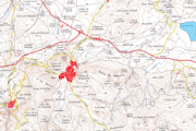
Base cartográfica del mapa Guía Parque Natural Sierras Subbéticas del año 2004.
Imágenes ráster del Mapa Guía Parque Natural Sierras Subbéticas del año 2004, escala 1:40.000, incluyendo la georreferenciación de los mismos.
Simple
- Date (Creation)
- 2008-05-12
- Citation identifier
- Sin identificador
- Presentation form
- Digital image
- Purpose
-
Base de referencia del Espacio Natural Sierra Subbéticas, quedando excluida la representación gráfica susceptible de actualizaciones (p.e. Equipamientos de Uso Público).
- Status
- Completed
- Point of contact
-
Organisation name Individual name Electronic mail address Role Consejería de Medio Ambiente y Ordenación del Territorio. Junta de Andalucía
Author
- Theme
-
-
Sendero
-
Espacios protegidos
-
IDEAndalucia
-
-
GEMET - INSPIRE themes, version 1.0
-
-
Ortoimágenes
-
- Use limitation
-
Derechos de propiedad intelectual.
- Access constraints
- Intellectual property rights
- Use constraints
- Intellectual property rights
- Spatial representation type
- Grid
- Language
- Spanish; Castilian
- Character set
- UTF8
- Topic category
-
- Imagery base maps earth cover
))
- Supplemental Information
-
0701010901
- Reference system identifier
- EPSG:25830
- Reference system identifier
- INSPIRE RS registry / http://www.opengis.net/def/crs/EPSG/0/4258
- Distribution format
-
Name Version TIFF
PDF
lyr
- Units of distribution
-
Datos en descarga
- OnLine resource
-
Protocol Linkage Name WWW:LINK-1.0-http--related
http://descargasrediam.cica.es/repo/s/RUR?path=%2F07_PATRIMONIO_NATURAL%2F01_ESPACIOS_PROTEGIDOS%2F01_RENPA%2F09_GUIAS%2F01_MAPAS_GUIA%2FMG_Subbeticas_2004 Descarga Base cartográfica del mapa Guía Parque Natural Sierras Subbéticas del año 2004. (MG_Subbeticas_2004)
- Hierarchy level
- Dataset
Conformance result
- Date (Publication)
- 2010-12-08
Citation identifier
- Explanation
-
Consultar el reglamento mencionado
- Pass
- Yes
- Statement
-
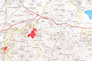
Georreferenciado de la imagen RASTER del Mapa Guía del Parque Natural Sierras Subbéticas del año 2004
- Description
-
Georreferenciación del mapa rasterizado utilizando la herramienta de ArcMap, Georreferencing. Transformación afín, de primer orden.
- Date / Time
- SIN FECHAT00:00:00
- Description
-
Consejería de Medio Ambiente. Consejería de Obras Públicas y Transportes, Instituto de Cartografía de Andalucía.
- File identifier
- da98d35d-e608-4e9d-aa32-eacdbc274bf3 XML
- Metadata language
- Spanish; Castilian
- Character set
- UTF8
- Hierarchy level
- Dataset
- Date stamp
- 2022-09-01T10:03:29
- Metadata standard name
-
ISO 19115 "NEM"
- Metadata standard version
-
2003 "1.0"
- Metadata author
-
Organisation name Individual name Electronic mail address Role Consejería de Sostenibilidad, Medio Ambiente y Economía Azul. Junta de Andalucía
Author
Overviews
Spatial extent
Provided by
