 Catálogo REDIAM
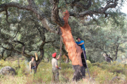
Mapa de unidades del Plan Forestal Andaluz histórico
Este contenido recopila la cartografía de las Unidades del Plan Forestal Andaluz que han sido elaboradas clasificando los recintos del Mapa de Usos y Coberturas Vegetales de Andalucía a 1:25.000 de los años 1999-2003 y 2007. A partir del año 2013 se continua la seríe, pero la clasificación del PFA se realiza sobre los polígonos del Sistema de Información del Patrimonio Natural de Andalucía. (SIPNA10)
Simple
- Date (Creation)
- 2006-12-13
- Citation identifier
- Sin identificador
- Presentation form
- Digital document
- Purpose
-
Servir de cartografía base para el desarrollo de trabajos forestales.
- Status
- Historical archive
- Point of contact
-
Organisation name Individual name Electronic mail address Role Consejería de Medio Ambiente y Ordenación del Territorio. Junta de Andalucía
Author
-
Registro de temas REDIAM
-
-
Biodiversidad y Vegetación
-
- Theme
-
-
Uso del suelo
-
Vegetación
-
IDEAndalucia
-
Opendata
-
-
GEMET - INSPIRE themes, version 1.0
-
-
Distribución de las especies
-
- Access constraints
- Other restrictions
- Use constraints
- Other restrictions
- Other constraints
-
Creative Commons Attribution 4.0 International Public License (CC BY 4.0)
- Spatial representation type
- Vector
- Denominator
- 25000
- Language
- Spanish; Castilian
- Character set
- UTF8
- Topic category
-
- Biota
- Imagery base maps earth cover
))
- Supplemental Information
-
Inf_archivo/04_RECURSOS_NATURALES/01_BIODIVERSIDAD/01_VEGETACION_ECOSISTEMAS/01_VEGETACION_NATURAL/02_ECOSISTEMAS_FORESTALES/02_PLAN_FORESTAL_ANDALUZ/PFA_historico
- Reference system identifier
- EPSG:25830
- Reference system identifier
- INSPIRE RS registry / http://www.opengis.net/def/crs/EPSG/0/4258
- Distribution format
-
Name Version PDF
ods
ESRI Shapefile
1.0
- Units of distribution
-
Datos en descarga
- OnLine resource
-
Protocol Linkage Name WWW:LINK-1.0-http--related
https://portalrediam.cica.es/descargas?path=%2FInf_archivo%2F04_RECURSOS_NATURALES%2F01_BIODIVERSIDAD%2F01_VEGETACION_ECOSISTEMAS%2F01_VEGETACION_NATURAL%2F02_ECOSISTEMAS_FORESTALES%2F02_PLAN_FORESTAL_ANDALUZ%2FPFA_historico Descarga Mapa de unidades del Plan Forestal Andaluz histórico
OnLine resource
- Hierarchy level
- Dataset
Conformance result
- Date (Publication)
- 2010-12-08
Citation identifier
- Explanation
-
Consultar el reglamento mencionado
- Pass
- Yes
- Description
-
Asignación de la categoría del Plan Forestal Andaluz que le corresponda a cada polígono en función de su código de uso, la/s especie/s arbóreas y la/s especies arbustivas que tenga asignadas.
Unión de los polígonos adyacentes con la misma categoría del Plan Forestal Andaluz.
- Date / Time
- 2006-01-02T00:00:00
- Description
-
Mapa de Usos y Coberturas Vegetales a escala 1:25.000 de Andalucía, año 2003.
- File identifier
- e5a41142-0365-4433-9e4c-2571c0ed2ccc XML
- Metadata language
- Spanish; Castilian
- Character set
- UTF8
- Hierarchy level
- Dataset
- Date stamp
- 2024-12-30T13:16:19.098Z
- Metadata standard name
-
ISO 19115 "NEM"
- Metadata standard version
-
2003 "1.0"
- Metadata author
-
Organisation name Individual name Electronic mail address Role Consejería de Sostenibilidad, Medio Ambiente y Economía Azul. Junta de Andalucía
Author
Overviews
Spatial extent
Provided by
