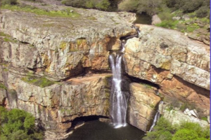
Inventario de Lugares de Interés Hidrogeológico (LIH) de Andalucía. 2006
El presente contenido se enmarca en una de las actividades contempladas en el Convenio entre la Agencia Andaluza del Agua y el Instituto Geológico y Minero de España (IGME). En particular, esta actividad se centra en la identificación de los principales Lugares de Interés Hidrogeológico (LIH) distribuidos en toda la geografía regional andaluza y que tienen particular interés por el patrimonio cultural, social, medioambiental, didáctico, recreativo, científico y funcional que integran. Escala 1:10.000. Año 2006.
Simple
- Date (Creation)
- 2006-12-18
- Presentation form
- Digital document
- Purpose
-
Conocer los lugares de interés hidrogeológico en Andalucía, su localización y características.
- Status
- Historical archive
- Point of contact
-
Organisation name Individual name Electronic mail address Role Consejería de Sostenibilidad y Medio Ambiente. Junta de Andalucía
Point of contact Instituto Geológico y Minero de España
Originator
- Theme
-
-
hidrogeología
-
protección de las aguas subterráneas
-
aguas superficiales
-
IDEAndalucia
-
Opendata
-
-
Registro de temas REDIAM
-
-
Geodiversidad
-
Agua
-
-
GEMET - INSPIRE themes, version 1.0
-
-
Hidrografía
-
Geología
-
- Access constraints
- Other restrictions
- Use constraints
- Other restrictions
- Other constraints
-
Creative Commons Attribution 4.0 International Public License (CC BY 4.0)
- Spatial representation type
- Vector
- Denominator
- 10000
- Language
- Spanish; Castilian
- Character set
- UTF8
- Topic category
-
- Environment
- Geoscientific information
- Inland waters
- Location
))
- Supplemental Information
-
\04_RECURSOS_NATURALES\04_AGUAS\02_SUBTERRANEAS\Lugares_Interes_Hidrogeologico_Andalucia_2006
- Reference system identifier
- EPSG:3042
- Reference system identifier
- INSPIRE RS registry / http://www.opengis.net/def/crs/EPSG/0/3042
- Distribution format
-
Name Version ESRI Shapefile
1.0
Geopackage
PDF
- Units of distribution
-
Servicio WMS
- OnLine resource
-
Protocol Linkage Name OGC:WMS-1.1.1-http-get-map
http://www.juntadeandalucia.es/medioambiente/mapwms/REDIAM_Lugares_Interes_Hidrogeologico
- Units of distribution
-
Servicio WFS
- OnLine resource
-
Protocol Linkage Name OGC:WFS
http://www.juntadeandalucia.es/medioambiente/mapwms/REDIAM_WFS_RN_Aguas?
- Units of distribution
-
Datos en descarga
- OnLine resource
-
Protocol Linkage Name WWW:DOWNLOAD-1.0-http--download
https://portalrediam.cica.es/descargas?path=%2F04_RECURSOS_NATURALES%2F04_AGUAS%2F02_SUBTERRANEAS%2FLugares_Interes_Hidrogeologico_Andalucia_2006 Descarga Lugares de Interés Hidrogeológico (LIH) de Andalucía (Lugares_Interes_Hidrogeologico_Andalucia_2006)
- Units of distribution
-
Ficha WMS
- OnLine resource
-
Protocol Linkage Name WWW:LINK-1.0-http--related
http://www.juntadeandalucia.es/medioambiente/site/rediam/menuitem.04dc44281e5d53cf8ca78ca731525ea0/?vgnextoid=a95b380c000d9210VgnVCM1000001325e50aRCRD&vgnextchannel=aa34fa937370f210VgnVCM1000001325e50aRCRD&vgnextfmt=rediam&lr=lang_es Ficha WMS Mapa de lugares de interés hidrogeológico de Andalucía
- Units of distribution
-
Ficha WFS
- OnLine resource
-
Protocol Linkage Name WWW:LINK-1.0-http--related
http://www.juntadeandalucia.es/medioambiente/site/rediam/menuitem.04dc44281e5d53cf8ca78ca731525ea0/?vgnextoid=e113579b642ee210VgnVCM1000001325e50aRCRD&vgnextchannel=cb43d61d8470f210VgnVCM2000000624e50aRCRD&vgnextfmt=rediam&lr=lang_es Ficha WFS Aguas superficiales y subterráneas
- Hierarchy level
- Dataset
Conformance result
- Date (Publication)
- 2010-12-08
Citation identifier
- Explanation
-
Consultar el reglamento mencionado
- Pass
- Yes
- Description
-
Trabajo de gabinete: recopilación bibliográfica y consulta, elaboración de ficha-tipo, diseño del procedimiento de selección delos LIHs (inclusión en más de un documento previo en el que se destaque su interés, establecimiento de categorías LIH).
Trabajo de campo destinado a describir, valorar y cartografiar los LIH para posteriormente realizar una valoración.
- Description
-
Capas gráficas proyectadas al sistema de referencia oficial (ETRS89, UTM Zona 30N, EPSG:3042). En la capa de geometría puntual se han sustituido los campos Point_x y Point_y por X_ED50 e Y_ED50 respectivamente, y se han añadido 2 nuevos campos X_ETRS89 e Y_ETRS89. Ambas capas se han incluido en una geopackage.
- Date / Time
- 2021-06-18T00:00:00
- File identifier
- f85cad6d-832e-462f-a69e-ff1edcbe55c0 XML
- Metadata language
- Spanish; Castilian
- Character set
- UTF8
- Hierarchy level
- Dataset
- Date stamp
- 2024-11-14T08:32:40.617Z
- Metadata standard name
-
ISO 19115 "NEM"
- Metadata standard version
-
2003 "1.0"
- Metadata author
-
Organisation name Individual name Electronic mail address Role Consejería de Sostenibilidad y Medio Ambiente. Junta de Andalucía
Author
Overviews

Spatial extent
))
Provided by

 Catálogo REDIAM